
No products in the cart.
What Is a GPS System? How It Works and Where It’s Used
How It Works and Where It’s Used
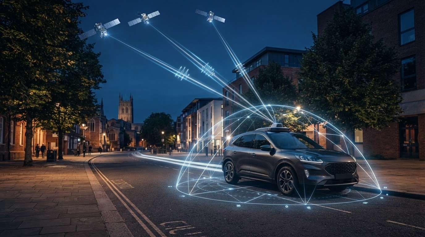
A vehicle tracker doesn’t find a car by magic. It uses satellite signals to calculate a position, while the tracker hardware and connected services turn that location into useful information. If you’ve searched for “what is GPS systems”, the short answer is that a receiver works out its distance from several satellites and uses those measurements to estimate its location.
GPS, GNSS and vehicle tracking are related, but they aren’t the same thing. GPS is one satellite navigation system. GNSS is the broader term for systems such as GPS, Galileo, GLONASS and BeiDou. This guide explains how GPS determines location, why buildings and other obstructions can affect reception, and how satellite positioning can support vehicle tracking. You’ll also see where GPS ends and tracker hardware or connected services begin, so you can understand how insurance-approved vehicle trackers fit into the picture.
Key Takeaways
- Learn what GPS systems are and how satellite signals help a receiver estimate position and time.
- Follow the steps behind GPS positioning, from satellite transmissions to a calculated location.
- Understand how GPS differs from GNSS, the broader group that includes Galileo, GLONASS and BeiDou.
- See why estimating a location and sharing it are separate parts of navigation and tracking.
- Discover how GPS positioning can support vehicle tracking, while tracker hardware and connected services determine how location information is used.
What is a GPS? The simple definition and its purpose
A GPS uses satellite signals and a receiver to estimate the receiver’s position and the current time. Satellites transmit signals containing timing information. A GPS receiver processes those signals to work out where it is. This is positioning: it tells the receiver its location, but it doesn’t automatically send that location to anyone else.
That distinction matters for vehicle security. The GPS constellation is the group of satellites transmitting signals. A GPS receiver is the component in a device, such as a phone or vehicle tracker, that calculates a position. A complete tracking service may also use tracker hardware and a separate communication connection to share location information. GPS alone doesn’t provide remote tracking, monitoring or theft recovery.
What does GPS stand for?
GPS stands for Global Positioning System. It’s one satellite navigation system, not a generic name for every system that helps determine location. The broader term is GNSS, short for Global Navigation Satellite System, which includes GPS and other systems. The Global Positioning System reference provides more detail on GPS technology and its place within GNSS.
This distinction explains why a device may use signals from more than one satellite navigation system. GPS refers specifically to one system; GNSS describes the wider category.
What can a GPS receiver tell you?
A GPS receiver calculates an estimated position from the satellite signals it receives. It can also derive timing information from those signals. For example, a phone can use its built-in receiver to estimate where it is, even when it isn’t using mobile data to calculate that position.
Positioning and communication are separate functions. A phone may need an internet connection to load online maps or traffic updates, but GPS doesn’t use that connection to calculate its position. Similarly, a vehicle tracker can use satellite positioning to determine where a vehicle is, while its hardware and connected services govern whether and how that information is transmitted.
In practical terms, GPS provides positioning, while tracker hardware and connected services determine how a vehicle’s location can be used or shared. Keeping those functions separate helps explain how GPS contributes to vehicle tracking without making a location estimate a guarantee of monitoring or recovery.
How does GPS work? From satellite signals to a location
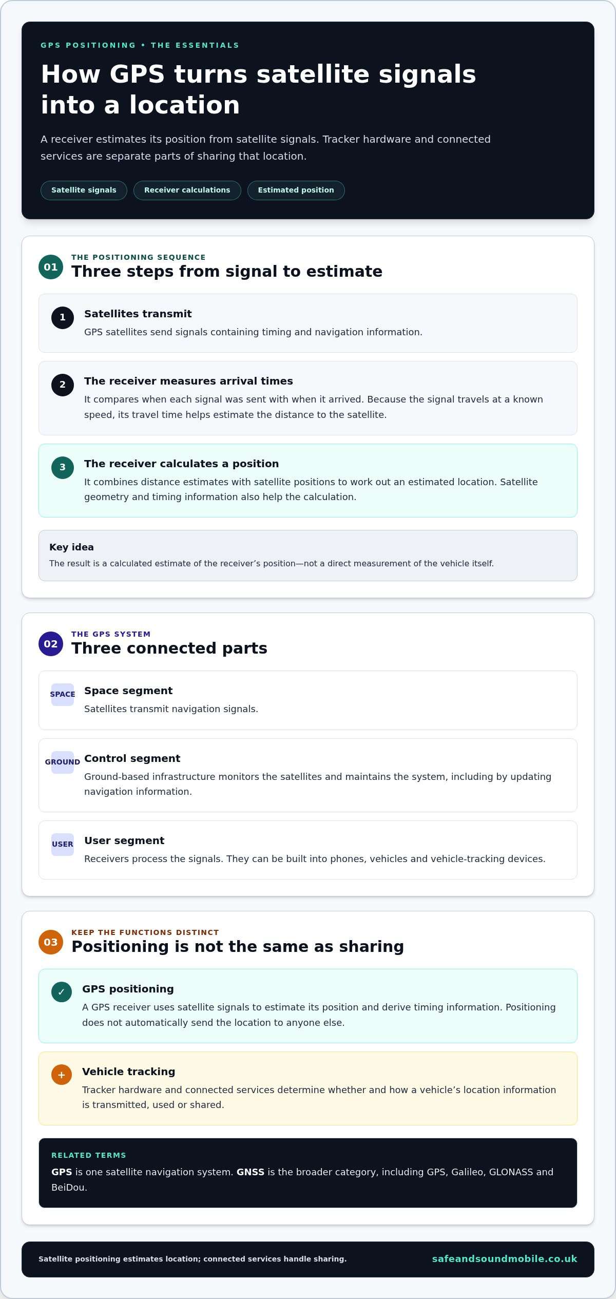
GPS works by comparing the timing of signals received from satellites. Each signal carries information that helps a receiver estimate how far away the satellite is. The receiver combines those distance estimates to calculate its position. In simple terms, GPS systems turn satellite signals into a location estimate through three steps: satellites transmit, the receiver measures, then it calculates.
What are the three parts of a GPS?
GPS is commonly described through three connected parts. The space segment consists of satellites transmitting navigation signals. The control segment is ground-based infrastructure that monitors the satellites and maintains the system, including updating navigation information. The user segment includes receivers that process the signals. These can be built into phones, vehicles and vehicle-tracking devices. Official US government information about GPS explains the system’s segments and how it operates.
How does a receiver turn signals into a position?
Here’s the process in simple steps:
- Satellites transmit signals. Each signal includes timing and navigation information.
- The receiver measures arrival times. It compares when signals were sent with when they arrived. Since the signals travel at a known speed, their travel time helps estimate the distance to each satellite.
- The receiver combines the estimates. It uses the distances and satellite positions to calculate a location.
This process is often explained through trilateration. Imagine overlapping circles around satellites, each representing an estimated distance. Their intersection narrows the receiver’s position. In practice, GPS calculations are more involved. They account for timing differences, satellite information and receiver factors, rather than relying on perfectly measured circles.
Satellite geometry also matters. Signals from satellites spread across different parts of the sky help the receiver distinguish between possible positions. Additional signal information supports a three-dimensional position estimate, including altitude, and helps resolve the receiver’s clock timing. The result is a calculated estimate, not a direct measurement of the vehicle itself.
In vehicle tracking, positioning is only one part of the process. Tracker hardware and connected services determine how the location is handled or shared. For vehicle security, insurance-approved vehicle trackers bring positioning technology into a fitted vehicle device.
GPS vs GNSS: accuracy, satellite systems and signal limits
GPS and GNSS are closely related terms, but they don’t mean the same thing. GPS is one satellite navigation system; GNSS is the broader category that includes GPS and other systems. The United States operates GPS, while Galileo is the European Union’s system, GLONASS is Russia’s system, and BeiDou is China’s system.
For people searching “what is GPS systems” technology, the key distinction is that GPS is a specific system, while GNSS is the wider category. A receiver may be designed to use GPS alone or to work with other satellite systems too.
| Term | What it means | Examples |
|---|---|---|
| GPS | A particular satellite navigation system | GPS, operated by the United States |
| GNSS | The collective term for global satellite navigation systems | GPS, Galileo, GLONASS and BeiDou |
What is the difference between GPS and GNSS?
Think of GNSS as the category and GPS as one member. A compatible receiver may process signals from multiple GNSS constellations. More satellites provide more signals to work with, but not every device supports every system, and more signals don’t guarantee a particular level of accuracy.
What can affect GPS signal accuracy?
Signal conditions make a practical difference. A receiver with a clear view of the sky may perform differently from one surrounded by obstructions. Tall buildings can block signals or reflect them off surfaces. Tunnels interrupt satellite visibility, while dense surroundings can make it harder for a receiver to obtain a clear set of signals.
Reflected signals may take a longer route to the receiver than direct signals. This can affect the distance calculations used to estimate position. Receiver design and capability also matter, so no single accuracy figure applies everywhere or to every device. A location estimate can vary with the receiver, the available satellite signals and the surroundings.
The Federal Aviation Administration’s How GPS Works guide explains the role of satellite signal timing. The same basic principle applies to GPS and other GNSS: a receiver uses received signals to calculate its position, while local conditions can influence the result.
Where are GPS systems used, and what are their limits?
GPS is used wherever a device needs to estimate its position. In everyday life, that can mean turn-by-turn navigation, location-aware features on a phone or a vehicle tracker calculating where a car is. Understanding what GPS systems do also means recognising their limits: a position estimate isn’t the same as a live update sent to another person.
How is GPS used in cars and other devices?
A phone or sat-nav receives satellite signals and calculates its own position. Navigation software can then show where you are on a map or help plan a route. Location-aware services may use the position for features such as local information, depending on the device and its settings.
A vehicle tracker can also use satellite positioning to estimate a vehicle’s location. What happens next depends on the tracker and its connected services. To view a location remotely, the device needs a way to send information, such as a suitable communications connection. GPS signals help calculate position; they don’t transmit that position to a phone or tracking platform on their own. Tracking technology is also widely used in broader vehicle logistics; for example, US motorists needing long-distance vehicle relocation can explore Open Car Transport to move a car safely across state lines.
Can GPS work without mobile data?
Yes. A receiver can calculate its position from satellite signals without using mobile data. But that doesn’t mean every related feature works offline. Online maps may need a data connection to load, and network-assisted features or a tracker’s remote reporting depend on the device and the communication service it uses.
This is the key distinction for vehicle owners: a tracker may determine a location using satellite signals, while a separate connection is needed to report it elsewhere. A position calculated inside the device isn’t automatically a location update you can see remotely.
GPS can estimate a device’s position and support navigation or tracking, but signal reception and remote updates aren’t guaranteed in every situation. Buildings, tunnels and other physical surroundings can weaken or block satellite signals. The device’s ability to communicate its position is separate, so don’t assume GPS alone provides continuous updates, monitoring, or theft recovery.
For vehicle security, Safe & Sound Mobile supplies insurance-approved vehicle trackers with mobile installation across the UK. Explore insurance-approved vehicle trackers to see how a tracker can bring positioning technology into a vehicle security setup.
How GPS positioning fits into vehicle tracking and vehicle security
GPS can estimate a vehicle’s position, but that’s only one part of vehicle tracking. The receiver inside a tracker processes satellite signals to calculate a location. The tracker’s hardware and associated services determine whether it shares that information, how it reports it, and what other functions it offers. GPS alone doesn’t provide remote monitoring or guarantee recovery of a stolen vehicle.
For drivers asking what GPS systems do in a vehicle security setup, the distinction is straightforward: GPS helps establish location. At the same time, a tracker uses positioning technology as part of a device and service. Understanding the difference can help you assess what a vehicle-tracking arrangement actually does.
What is the difference between GPS and a car tracker?
GPS is a satellite positioning system. A car tracker is a device that can use GPS or other positioning technology to estimate a vehicle’s location. To make that location available remotely, the tracker needs a way to communicate it. Reporting frequency and other functions depend on the device and associated service, not GPS itself.
For a fuller explanation of tracker components and how they work together, read Vehicle Tracking Explained.
When could an insurance-approved tracker be relevant?
Some vehicle owners may need an insurance-approved tracker to meet a policy requirement. This won’t apply to every driver, so check your vehicle’s terms. Where a tracker is needed, the required category matters: Safe & Sound Mobile supplies insurance-approved trackers in Thatcham S5 and S7 categories. These are categories offered by the business, not a promise that every tracker or service has the same capabilities.
Read Insurance Approved Vehicle Trackers for more information about the category, then consider how a professionally fitted tracker could form part of your vehicle security setup. Safe & Sound Mobile provides mobile installation across the UK.
Keep the roles clear: GPS estimates position, tracker hardware processes or uses that information, and connected services determine how it can be reported. That’s the practical link between satellite positioning and vehicle security, without assuming that GPS alone provides tracking or recovery.
Explore Safe & Sound Mobile’s insurance-approved vehicle trackers and mobile installation options to take the next step towards a fitted vehicle security solution.
Put GPS positioning to work for vehicle security.
Understanding what GPS systems do comes down to two useful points: GPS helps a receiver estimate its position, and GNSS is the wider group of satellite navigation systems. Areceiver’ss location estimate is only the positioning step. Tracker hardware and connected services determine how that information is used or shared.
This distinction matters for vehicle security. GPS alone doesn’t provide remote tracking, monitoring or theft recovery, and tracker capabilities vary by device and service. If you’re considering a tracker, some vehicle insurance policies may require an approved category. Safe & Sound Mobile supplies insurance-approved vehicle trackers in Thatcham S5 and S7 categories, with mobile installation available across the UK.
Choose a vehicle security solution with a clear understanding of how satellite positioning fits into the wider tracker setup. Explore insurance-approved vehicle trackers and UK-wide mobile fitting, then take a confident next step toward protecting your vehicle.
Frequently Asked Questions
What is a GPS?
A GPS uses satellite signals and a receiver to estimate location and time. GPS stands for Global Positioning System. The receiver compares signal timing to calculate its position, while the satellites provide the signals it needs. GPS is one satellite navigation system; GNSS is the wider category that includes GPS and other systems. A GPS receiver can calculate a location without automatically tracking a remote vehicle.
How does GPS work in simple terms?
GPS satellites transmit signals containing timing information. A receiver measures when signals arrive and uses the travel times to estimate its distance from several satellites. It combines those distance estimates with satellite information to calculate a position. The result depends on the receiver and the signals it can receive. Buildings, tunnels, and other obstructions can affect reception so that performance may differ between locations.
How accurate is a GPS?
GPS accuracy varies, so there isn’t one guaranteed result for every receiver and location. The receiver’s design, visible satellite signals and surrounding conditions all influence the position estimate. Buildings may block or reflect signals, and tunnels can interrupt reception. A device may therefore perform differently in open surroundings, among tall buildings or indoors. Treat accuracy as dependent on both the equipment and the conditions where it’s being used.
Is a GPS tracker the same as a car tracker?
No. GPS is satellite positioning technology; a car tracker is a device that may use positioning technology to estimate a vehicle’s location. The tracker’s design and associated service determine how it reports that information and what other functions it provides. GPS alone doesn’t mean a vehicle is being remotely monitored, and it can’t guarantee recovery if the vehicle is stolen. Tracker capabilities vary by device and service.
Can GPS signals be blocked or interrupted?
Yes. Physical surroundings can weaken or obstruct GPS signals, making it harder for a receiver to calculate a position. Buildings and tunnels can limit satellite reception, while signals reflected from nearby surfaces may affect the estimate. The impact depends on the location, available signals and receiver. GPS-based positioning shouldn’t be assumed to work identically in every setting or to provide uninterrupted location updates.


About author
Related posts

A dash cam’s recording time depends on its memory card and video quality. For a single-camera setup, a 32GB card stores around 2 to 4... Continue reading

Does a gps tracking dash cam let you find your car if it’s stolen? Not by itself. GPS can add location and journey context to... Continue reading
Could choosing the wrong tracker category leave your insurer’s requirement unmet? The right thatcham approved tracker installation uk starts with the... Continue reading

Real-Time GPS Tracking Chelmsford: Cars, Vans and Fleets Real-time GPS tracking can help vehicle owners and businesses in Chelmsford view location information through a supported... Continue reading

Thatcham Tracker Categories: S5, S7 and Older Labels Thatcham tracker categories can be confusing if your paperwork mentions Category 3, Category 5 or Category 6.... Continue reading